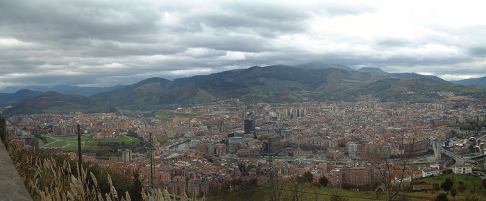
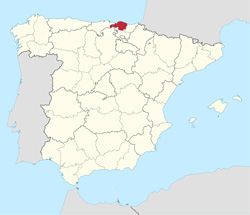
Bilbao in Biscay

Biscay province lies on the south shore of the eponymous bay. The name also refers to a historical territory of the Basque Country, heir of the ancient Lordship of Biscay. Its capital city is Bilbao. It is one of the most prosperous and important provinces of Spain as a result of the historical trading importance of its commercial ports after the middle ages and the massive industrialization during the last quarter of the 19th century and first half of the 20th century. Since the deep de-industrialisation of the 1970s, the economy has come to rely more on the services sector.

Biscay is bordered by the community of Cantabria and the province of Burgos (in the Castile and León community) to the west, the Basque provinces of Gipuzkoa to the east, and Álava to the south, and by the Cantabrian Sea (Bay of Biscay) to the north. Orduña (Urduña) is a Biscayan exclave located between Alava and Burgos provinces.
The climate is oceanic, with high precipitation all year round and moderate temperatures, which allow the lush vegetation to grow. Temperatures are more extreme in the higher lands of inner Biscay, where snow is more common during winter. The average high temperatures in main city Bilbao is between 13 °C (55 °F) in January and 26 °C (79 °F) in August.
The southern high mountain ranges, part of the Basque mountains, that form a continuous barrier with passes not lower than 600 m AMSL, forming the water divide of the Atlantic and Mediterranean basins. These ranges are divided from west to east in Ordunte (Zalama, 1390 m), Salbada (1100 m), Gorbea (1481 m) and Urkiola (Anboto, 1331 m).
The middle section which is occupied by the main river's valleys: Nervion, Ibaizabal and Kadagua. Kadagua runs west to east from Ordunte, Nervion south to north from Orduña and Ibaizabal east to west from Urkiola. Arratia river runs northwards from Gorbea and joins Ibaizabal. Each valley is separated by medium mountains like Ganekogorta (998m). Other mountains, like Oiz, separate the main valleys from the northern valleys. The northern rivers are: Artibai, Lea, Oka and Butron.
The coast: the main features are the estuary of Bilbao where the main rivers meet the sea and the estuary of Gernika (Urdaibai). The coast is usually high, with cliffs and small inlets and coves.
Biscay has been inhabited since the Middle Palaeolithic, as attested by the archaeological remains and cave paintings found in its many caves. The Roman presence had little impact in the region, and the Basque language and traditions have survived to this day.
Biscay was identified in records of the Middle Ages, as a dependency of the Kingdom of Pamplona (11th century) that became autonomous and finally a part of the Crown of Castile. The first mention of the name Biscay was recorded in a donation act to the monastery of Bickaga, located on the ria of Mundaka. According to Anton Erkoreka, the Vikings had a commercial base there from which they were expelled by 825. The ria of Mundaka is the easiest route to the river Ebro and at the end of it, the Mediterranean Sea and trade.
In the modern age, the province became a major commercial and industrial area. Its prime harbour of Bilbao soon became the main Castilian gateway to Europe. Later, in the 19th and 20th centuries, the abundance of prime quality iron ore and the lack of feudal castes favoured rapid industrialisation.


